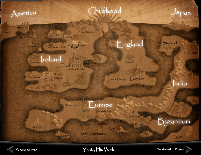
The storymap “Yeats, His World” from the National Library of Ireland is a prime example of how interactive mapping can imbue our understanding of an author’s connection to place. The map, which is part of a larger digital (and physical) exhibition on Yeats, organizes photos and biographical information on Yeats by country (and then, region) so users can explore the poet’s involvement with different areas of the world.
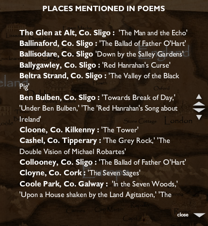
I found the map most informative for two central reasons: 1) the homepage shows the breadth and extent to which Yeats influenced different regions globally 2) it was useful for showing the relationship between select Yeats’s poems and specific locations. The website contains a key (which you can access by clicking the hypertext “mentioned in poems” on the bottom right, which lists each poem and a corresponding place:
This form of spatial learning is particularly important for an author like Yeats, whose poetry often centers on specific places in rural and urban Ireland. The map provides an image, for instance, of Yeats’ tower at Thoor Ballylee, a focal point for many poems in his collection The Tower.
As much as I appreciated the maps’ information, I did see some limitations in the design of the website. My main criticism is that it’s not easy to access the page where readers can navigate “Yeats, His World.” In fact, I doubt I would have found the project at all had I not seen it in the physical exhibition in Dublin. This is because the map is embedded as a child page in the larger digital exhibition on Yeats. Several instances (including twice during my own presentation, regrettably) I couldn’t access the childpage I needed at all, despite going through the same set of steps I had used to get “Yeats, His World” previously. Another issue I had with the map is that the design is crafted to look like an older, vintage map (most noticeably in the yellow coloring and torn edges at the sides) which I found a little corny considering the map actually uses a sophisticated digital interface. These criticisms aside, though, I felt the site was a useful template for my work in mapping out a digital biography to show how a historical figure intersects with different global regions.